Ing. Lucie Homolová, Ph.D. – head
Scientists:
Ing. Vojtěch Bárta, Ph.D.
Ing. Olga Brovkina, CSc.
Ing. Daniel Kopkáně, Ph.D.
Ing. Petr Lukeš, Ph.D.
Ing. Jan Novotný, Ph.D.
Ing. Miroslav Pikl, Ph.D.
doc. Mgr. Ing. František Zemek, Ph.D.
Ph.D. students:
MSc. Antonín Kusbach,
Mgr. Marian Švik
Others:
Ing. Barbora Navrátilová
Motto:
Science from above: we help to understand landscape changes using Earth observation data.
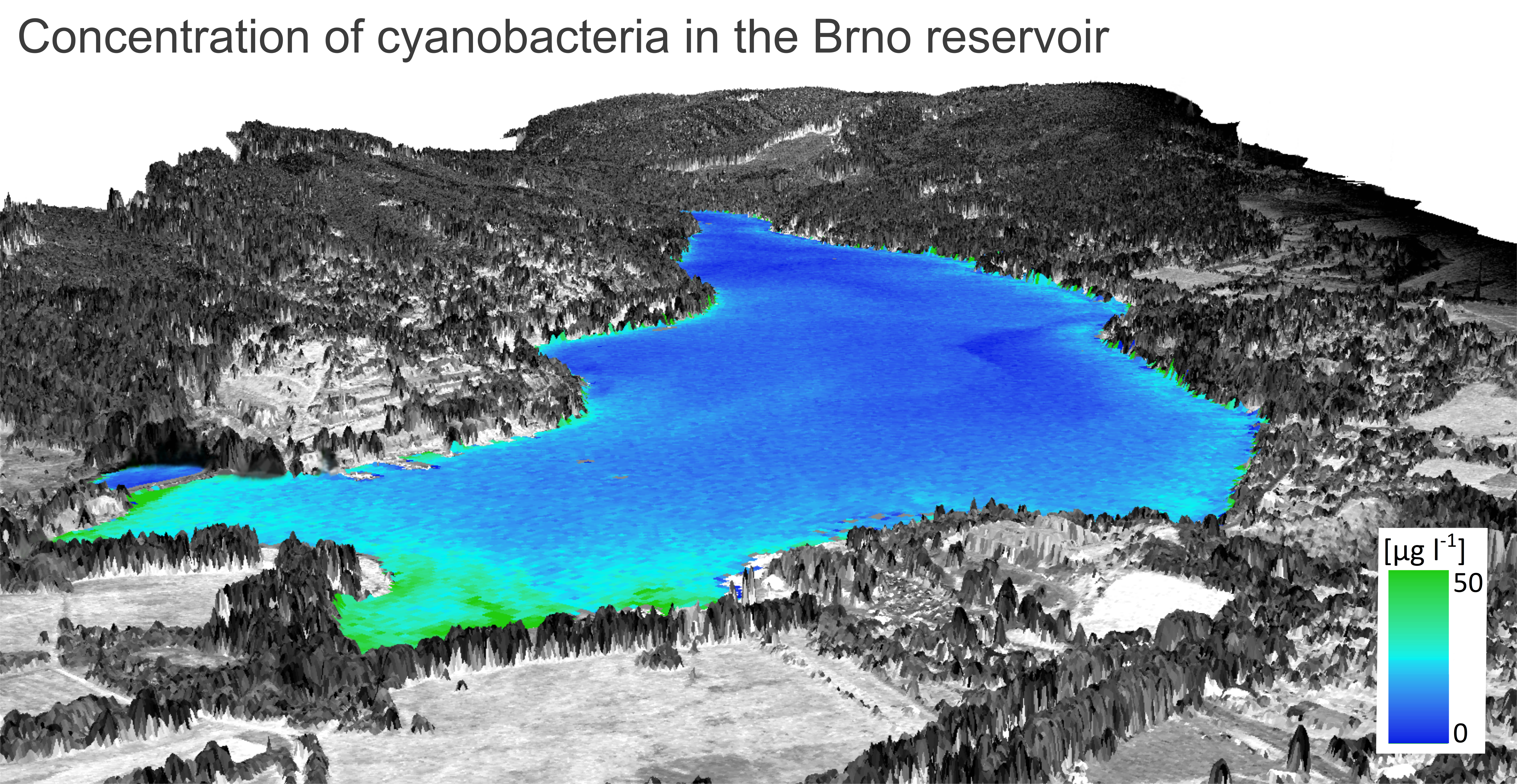
Our department studies the actual status and changes of ecosystems using the up-to-date and rapidly developing methods of remote sensing. Our goal is to develop innovative solutions for qualitative and quantitative assessment, study spatio-temporal changes of ecosystems and their response to various stress agents, and to explore new relationships between the ecosystem elements using different types of remote sensing and field data. We primarily study forest, agro and urban systems and our research is usually connected to the activities of other GCRI departments and other research institutes, because it often integrates a broad variety of data at different ecosystem levels (e.g., leaf – plant – canopy – landscape) at the local up to regional scales.
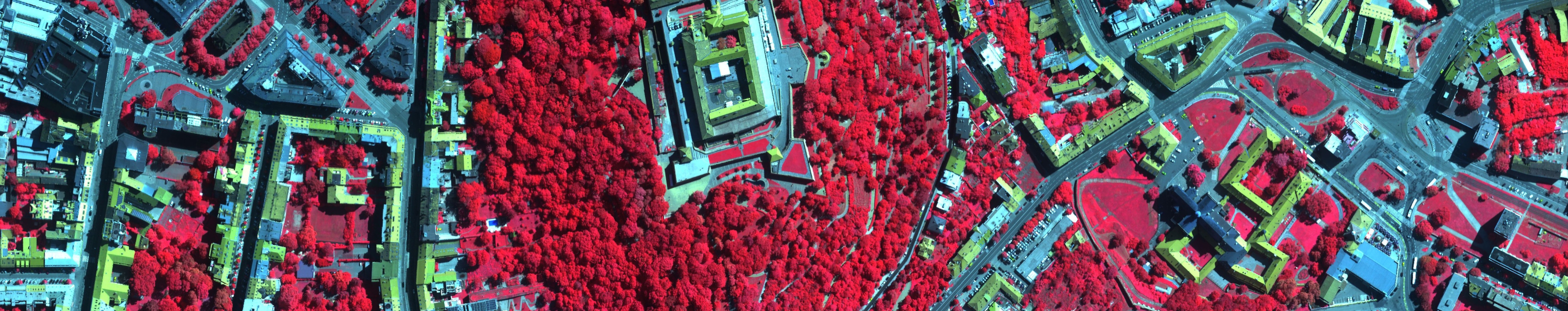
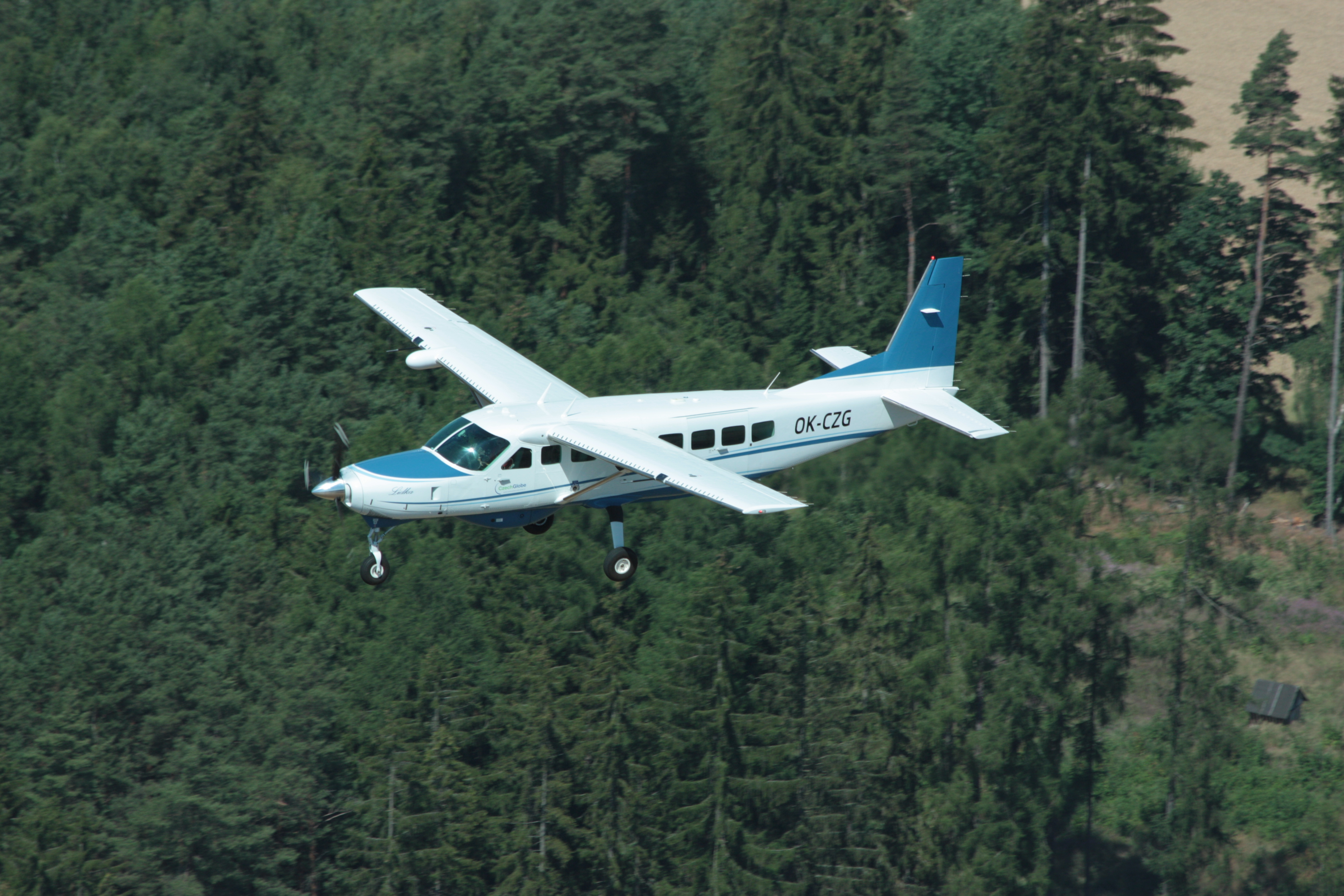
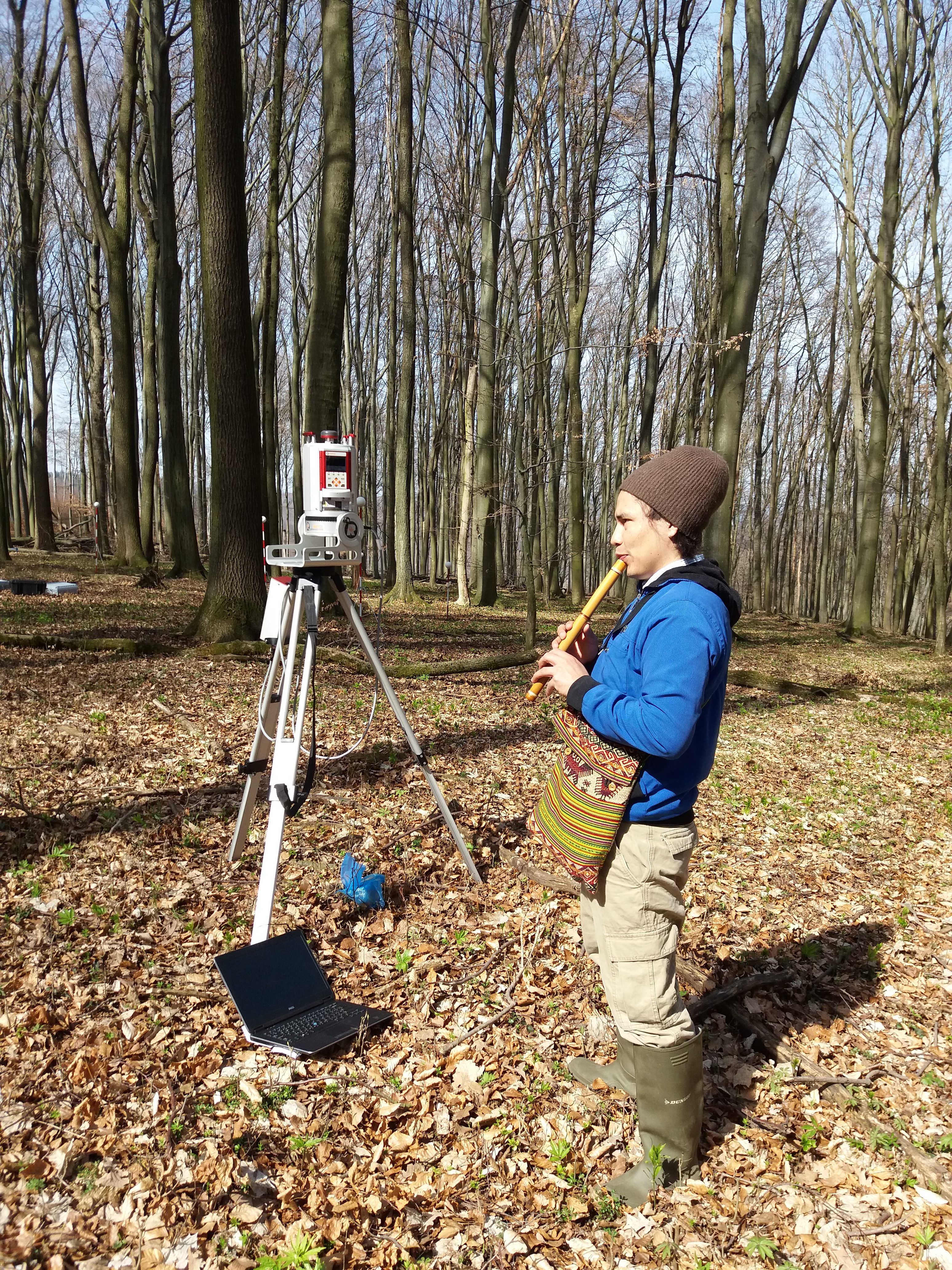
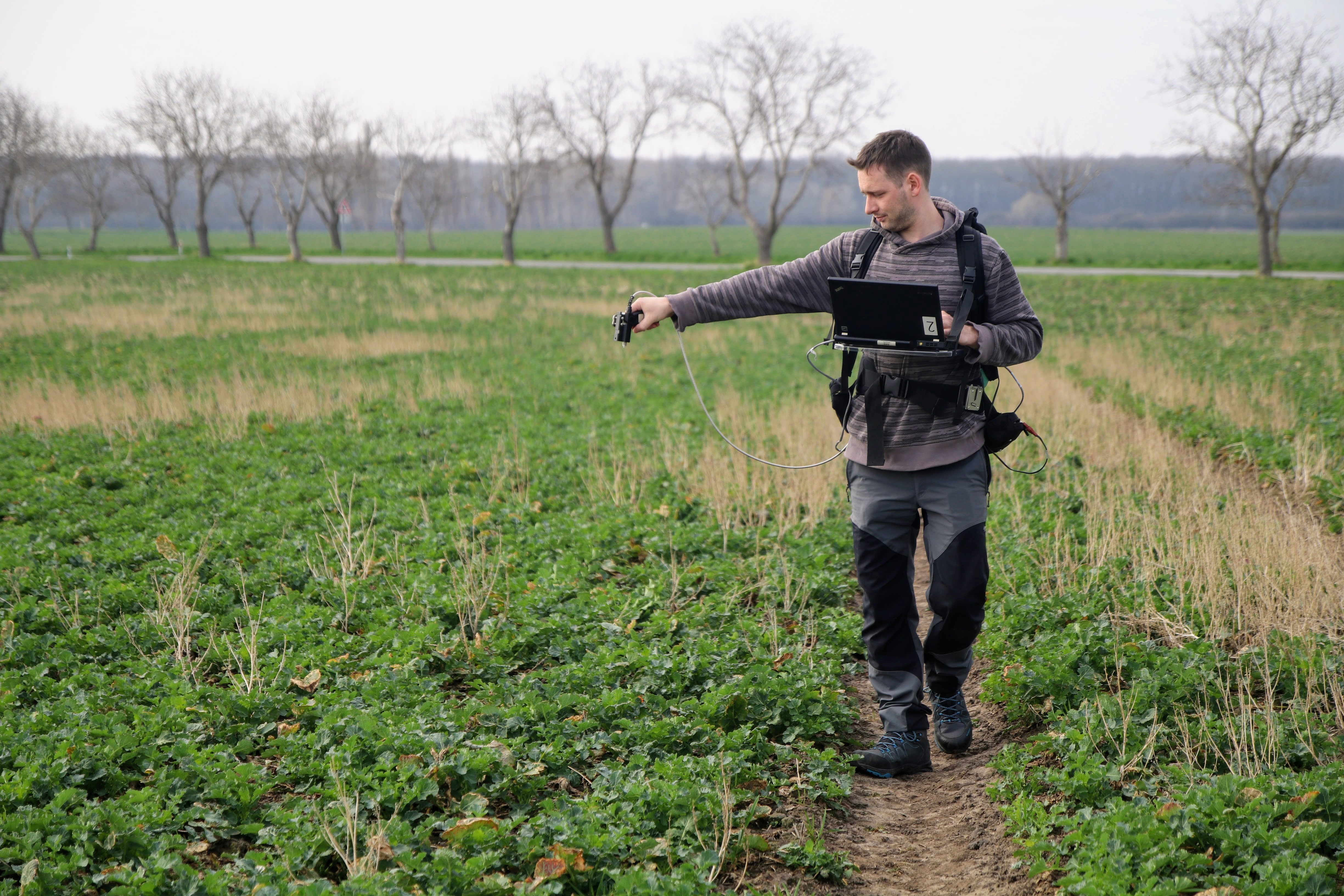
In our research we use an unique airborne research infrastructure of GCRI – Flying Laboratory of Imaging Systems (FLIS), which is the only one operated in the Czech Republic and one of few in Europe. 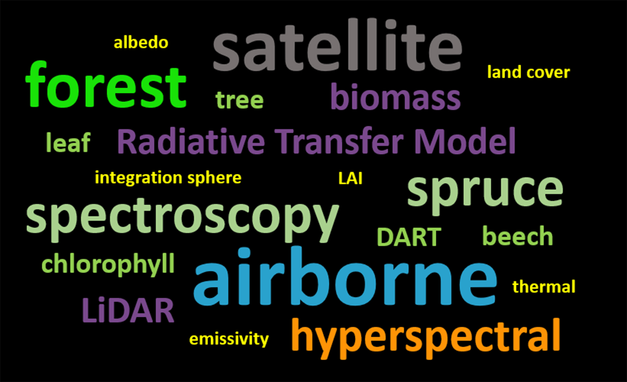 FLIS carries on-board a suite of state-of-the-art imaging spectroradiometers, thermal spectroradiometer and a laser scanner that allows simultaneous data acquisition and such as providing a comprehensive information about land surface. Besides the airborne data we also analyse multitude of field spectroscopic and laser scanning data, as well as satellite observations (e.g., Sentinels, Landsat, Modis).
Main research activities:
- Up-scaling of leaf-level spectral and biochemical properties to canopies and landscapes through 3D radiative transfer modelling.
- Quantitative estimation of vegetation traits (including leaf pigments, water content, leaf area index) for various types of crops and forests using different types of remote sensing data
- 3D modelling of forest structure from airborne and terrestrial laser scanning data towards better understanding of forest radiation budget and sun-induced chlorophyll fluorescence signal.
- Estimation of forest structure and inventory parameters (e.g. individual tree detection, species composition, tree height, crown width and productivity (e.g. aboveground biomass, leaf area) at different scales using airborne and satellite remote sensing data.
- Studying thermal heat fluxes in urban systems to support effective town planning and improve human well-being in towns.
Ongoing research projects:
- Prediction of the impact of unfavourable environmental risks on production and non-production functions of agricultural ecosystems using remote sensing methods (2020 – 2022; TAČR SS01020397)
- Operational assessment of aboveground biomass in forest ecosystems using advanced remote sensing methods (2019 – 2022; NAZV – QK1910150)
- Assessment of ecosystem function based on Earth observation of vegetation quantitative parameters retrieved from data with high spatial, spectral and temporal resolution (2019 – 2022; MŠMT Inter-Action – LTAUSA18154)
- Thermal comfort in urban areas: human perception, physics based reality, role of greenery (2019 – 2021; TAČR ÉTA – TL02000322)
- Development of instruments for planning and assessment of ecological benefit of greenery in towns (2019 – 2021; TAČR EPSILON – TH04030496)
Selected publications:
- Novotný J, Navrátilová B, Janoutová R, Oulehle F, Homolová L. Influence of Site-Specific Conditions on Estimation of Forest above Ground Biomass from Airborne Laser Scanning. Forests 2020, 11, 268.
- Janoutová R, Homolová L, Malenovský Z, Hanuš J, Lauret N, Gastellu-Etchegorry J-P Influence of 3D Spruce Tree Representation on Accuracy of Airborne and Satellite Forest Reflectance Simulated in DART. Forests 2019, 10, 292.
- Siegmann B, Alonso L, Celesti, M, Cogliati S, Colombo R et al. The High-Performance Airborne Imaging Spectrometer HyPlant—From Raw Images to Top-of-Canopy Reflectance and Fluorescence Products: Introduction of an Automatized Processing Chain. Remote Sensing 2019, 11, 2760.
- Rautiainen M, Lukeš P, Homolová L, Hovi A, Pisek J, Mõttus M. Spectral Properties of Coniferous Forests: A Review of In Situ and Laboratory Measurements. Remote Sensing 2018, 10, 207.
- Manakos I, Tomaszewska M, Gkinis I, Brovkina O et al. Comparison of Global and Continental Land Cover Products for Selected Study Areas in South Central and Eastern European Region. Remote Sensing 2018, 10, 1967.
- Pivovarník M, Khalsa S J S, Jiménez-Muñoz J C, Zemek F. Improved Temperature and Emissivity Separation Algorithm for Multispectral and Hyperspectral Sensors. IEEE Transactions on Geoscience and Remote Sensing 2017, 55(4), 1944-1953.
- Lukeš P, Homolová L, Navrátil M, Hanuš J. Assessing the consistency of optical properties measured in four integrating spheres.International Journal of Remote Sensing 2017, 38(13), 3817-3830.
- Brovkina O, Novotný J, Cienciala E, Zemek F, Russ R. Mapping forest aboveground biomass using airborne hyperspectral and LiDAR data in the mountainous conditions of Central Europe. Ecological Engineering 2016, 100, 219-230.
- Rossini M, Nedbal L, Guanter L, Ač A, Alonso L, et al. Red and far red Sun‐induced chlorophyll fluorescence as a measure of plant photosynthesis. Geophysical Research Letters 2015, 42, 1632– 1639.
Still not enough?
- See our short video about airborne remote sensing and how do we analyse and use the data
- Check the virtual guide into our airborne research facility (vložit jako odkaz na pano letadla

- Check where our airborne data acquisitions are located.
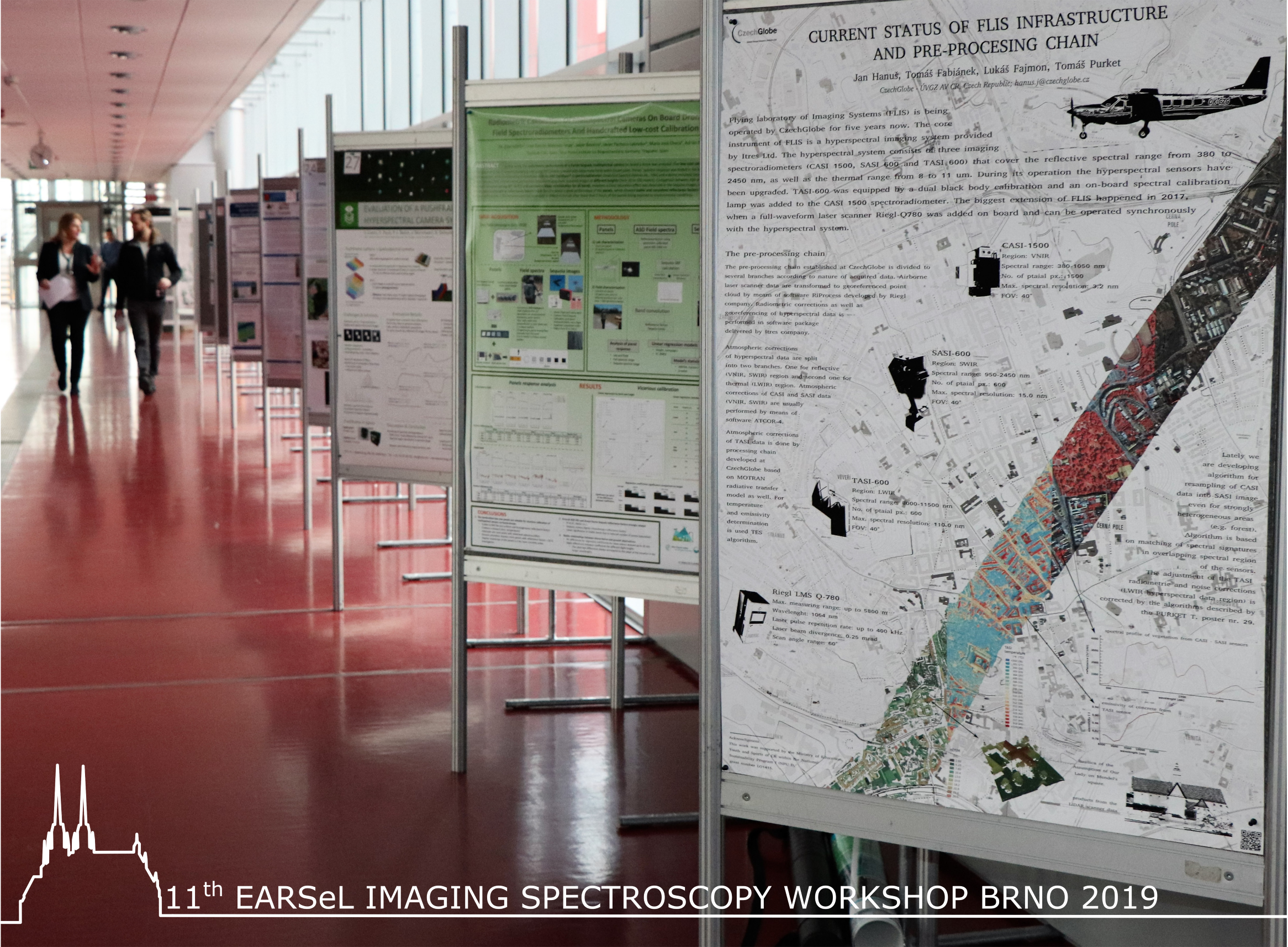
- Do you want to know the parameters of our airborne sensors and how the data are being processed? Visit the website of our technical department, which takes care of the airborne facility and its operation.
- Browse our book about airborne remote sensing
- Urban Vegetation and Ecology Monitoring Using Remote Sensing
Forest aboveground biomass assessment using an area-based approach – verified technology

Photogalery