The severe tornado that hit the region around Hodonín a week ago left a scar in the landscape that is visible from space. Department of Remote Sensing of CzechGlobe made an interactive web-based application tornado.czechglobe.cz that shows the changes in the landscape from the remote sensing perspective.
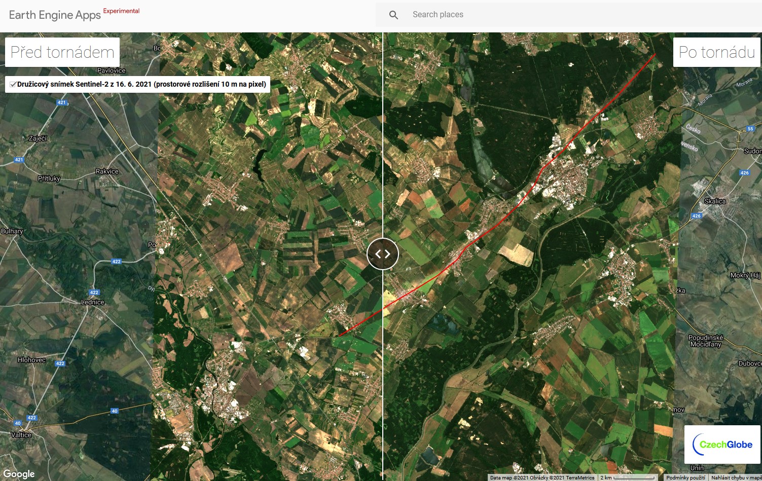
Using the satellite data of Sentinel-2, Planet and high resolution airborne images one can explore the changes before and after the tornado. The application can be accessed here