Provider: Ministerstvo školství mládeže a tělovýchovy
Recipient: Ústav výzkumu globální změny AV ČR, v. v. i.
Keywords: CzeCOS/ICOS
Annotation of project:
infrastuktura CzeCOS/ICOS
Click for the search
Number of projects found: 285
ACTRIS-2
Provider: EC - HORIZONT 2020
Another participant in the project / Organizational Unit guaranteeing Solutions: Český hydrometeorologický ústav
Keywords: aerosols, clouds, sholrt lived gases
Annotation of project:
ACTRIS-2 addresses the scope of integrating state-of-the-art European ground-based stations for long term observations of aerosols, clouds and short lived gases capitalizing work of FP7-ACTRIS. ACTRIS-2 aims to achieve the construction of a user-oriented RI, unique in the EU-RI landscape. ACTRIS-2 provides 4-D integrated highquality data from near-surface to high altitude (vertical profiles and total-column), relevant to climate and air-quality research. ACTRIS-2 develops and implements, in a large network of stations in Europe and beyond, observational protocols that permit harmonization of collected data and their dissemination. ACTRIS-2 offers networking expertise, upgraded calibration services, training of users, trans-national access to observatories and calibration facilities, virtual access to high-quality data products. Through joint research activities, ACTRIS-2 develops new integration tools that will produce scientific or technical progresses reusable in infrastructures, thus shaping future observation strategies. Innovation in instrumentation is one of the fundamental building blocks of ACTRIS-2. Associated partnership with SMEs stimulates development of joint-ventures addressing new technologies for use in atmospheric observations. Target user-groups in ACTRIS-2 comprise a wide range of communities worldwide. End-users are institutions involved in climate and air quality research, space agencies, industries, air quality agencies. ACTRIS-2 will improve systematic and timely collection, processing and distribution of data and results for use in modelling, in particular towards implementation of atmospheric and climate services. ACTRIS-2 invests substantial efforts to ensure longterm sustainability beyond the term of the project by positioning the project in both the GEO and the on-going ESFRI contexts, and by developing synergies with national initiatives.
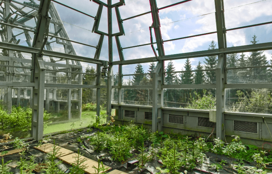
Optimize design of a new Vietnamese ecosystem research station
Provider: Akademie věd ČR
Recipient: Ústav výzkumu globální změny AV ČR, v. v. i.
Keywords: Eddy covariance, greenhouse gas fluxes, carbon sequestration, solar radiation measurement, leaf area index, ecosystem, climate change.
Annotation of project:
Eddy covariance as a main component of ecosystem stations is the most direct method for measurement of carbon and energy exchange between ecosystem and atmosphere and helps us to understand how ecosystems react to changes of bioclimatic variables, which is important to predict impacts of climate change and to advise adaptation or mitigation measures. The project aims to optimize the design of a new ecosystem research station in a natural forest ecosystem of Vietnam which represents Southern Annamites montane rain forests and has not been investigated yet. In particular, we will evaluate the site’s homogeneity level in terms of terrain, forest canopy, local wind conditions and understory light condition to select the most suitable position for a future eddy covariance flux tower and to design the station. Implementing of the project will also transfer know-how on eddy covariance flux research methods to Vietnamese partners and to evaluate the equipment for measurement of Leaf Area Index (LAI; LaiPen-100) developed in CVGZ in condition of tropical forests.
Monitoring sucha
Provider: Akademie věd ČR
Recipient: Ústav výzkumu globální změny AV ČR, v. v. i.
Keywords: Monitoring sucha
Annotation of project:
Monitoring sucha
Recipient: Ústav výzkumu globální změny AV ČR, v. v. i.
Keywords: Monitoring sucha
Annotation of project:
Monitoring sucha
dopady sucha
Provider: Akademie věd ČR
Recipient: Ústav výzkumu globální změny AV ČR, v. v. i.
Keywords: dopady sucha, analýza
Annotation of project:
Předpokládané výsledky projektu do konce roku 2015: - na základě požadavku odpovědných zástupců Jihomoravského kraje (JMK) bude pro 6 okresů (z celkového počtu 7 okresů - tedy mimo okres Brno-město) JMK zpracován výskyt sucha za rok 2015, - současně bude provedena historická analýza (1961-2014) výskytu sucha pro okresy JMK, - budou vytvořeny analýzy výskytu sucha pro kategorii S2 a S3 po měsících, po ročních obdobích či podle upřesněných požadavků partnera.
komplexní přístup pro monitorování sucha
Provider: Akademie věd ČR
Recipient: Ústav výzkumu globální změny AV ČR, v. v. i.
Keywords: sucho, dopad, analýza
Annotation of project:
Předpokládané výsledky projektu do konce roku 2015: - na základě požadavku odpovědných zástupců Jihomoravského kraje (JMK) bude pro 6 okresů (z celkového počtu 7 okresů - tedy mimo okres Brno-město) JMK zpracován výskyt sucha za rok 2015, - současně bude provedena historická analýza (1961-2014) výskytu sucha pro okresy JMK, - budou vytvořeny analýzy výskytu sucha pro kategorii S2 a S3 po měsících, po ročních obdobích či podle upřesněných požadavků partnera.
Mapping and Assessment of Ecosystems and their Services
Provider: Ministerstvo financí
Recipient: Ústav výzkumu globální změny AV ČR, v. v. i.
Keywords: ecosystem services
Annotation of project:
The aim of the activity is the participation at the conference on ecosystem mapping and assessment and ecosystem services organized by Norwegian Environment Agency on May 27-28, 2015, in Trondheim, Norway. The main bases for the conference are the Aichi targets for 2020 under the Convention on biological diversity (CBD), the EU Biodiversity Strategy to 2020, and the UN project on Economics of Ecosystems and Biodiversity (TEEB). The conference will also be aligned to work under the Intergovernmental Platform on Biodiversity and Ecosystem Services (IPBES) and the EU working group on Mapping and Assessment of Ecosystems and their Services (MAES). The conference will be an arena for learning, sharing experiences and best practices, and for discussing policy guidelines, methodology and practical approaches related to mapping and assessment of ecosystems and their services. In addition, the conference will be a platform for increased European cooperation on mapping and assessment of ecosystems and their services, in particular within the framework of the EEA and Norway Grants. At the conference will be presented the contribution Status and plans at the national level on exosystem services
HyPlant Processing Experiment
Provider: European Space Agency
Another participant in the project / Organizational Unit guaranteeing Solutions: Ústav výzkumu globální změny AV ČR, v. v. i.
Keywords: xx
Annotation of project:
xx
Another participant in the project / Organizational Unit guaranteeing Solutions: Ústav výzkumu globální změny AV ČR, v. v. i.
Keywords: xx
Annotation of project:
xx
CCN2 HYFLEX
Provider: European Space Agency
Keywords: xx
Annotation of project:
xx
Keywords: xx
Annotation of project:
xx
Enhancing ecoSysteM sERvices mApping for poLicy and Decision mAking
Provider: EC - HORIZONT 2020
Recipient: CHRISTIAN-ALBRECHTS-UNIVERSITAET ZU KIEL, Germany (CAU)
Another participant in the project / Organizational Unit guaranteeing Solutions: Ústav výzkumu globální změny AV ČR, v. v. i.
Keywords: mapping, ecosystems, biodiversity
Annotation of project:
Mapping and assessment of ecosystems and their services (ES) are core to the EU Biodiversity (BD) Strategy. They are essential if we are to make informed decisions. Action 5 sets the requirement for an EU-wide knowledge base designed to be: a primary data source for developing Europe’s green infrastructure; resource to identify areas for ecosystem restoration; and, a baseline against which the goal of ‘no net loss of BD and ES’ can be evaluated. In response to these requirements, ESMERALDA aims to deliver a flexible methodology to provide the building blocks for pan-European and regional assessments. The work will ensure the timely delivery to EU member states in relation to Action 5 of the BD Strategy, supporting the needs of assessments in relation to the requirements for planning, agriculture, climate, water and nature policy. This methodology will build on existing ES projects and databases (e.g. MAES, OpenNESS, OPERAs, national studies), the Millennium Assessment (MA) and TEEB. ESMERALDA will identify relevant stakeholders and take stock of their requirements at EU, national and regional levels. The objective of ESMERALDA is to share experience through an active process of dialogue and knowledge co-creation that will enable participants to achieve the Action 5 aims. The mapping approach proposed will integrate biophysical, social and economic assessment techniques. Flexibility will be achieved by the creation of a tiered methodology that will encompass both simple (Tier 1) and more complex (Tier 3) approaches. The work will exploit expert- and land coverbased methods, existing ES indicator data and more complex ES models. As a result the outcomes will be applicable in different contexts. The strength of the ESMERALDA consortium lies in its ability to make solutions for mapping and assessment problems available to stakeholders from the start of the project, because our expertise allows us to build on existing research projects and data sharing systems.
virtual infrastructure guide

HRS4R/HR AWARD

News
04/5/
2024
2024
Minister Hladík together with the scientists from CzechGlobe visited wetlands in South Bohemia
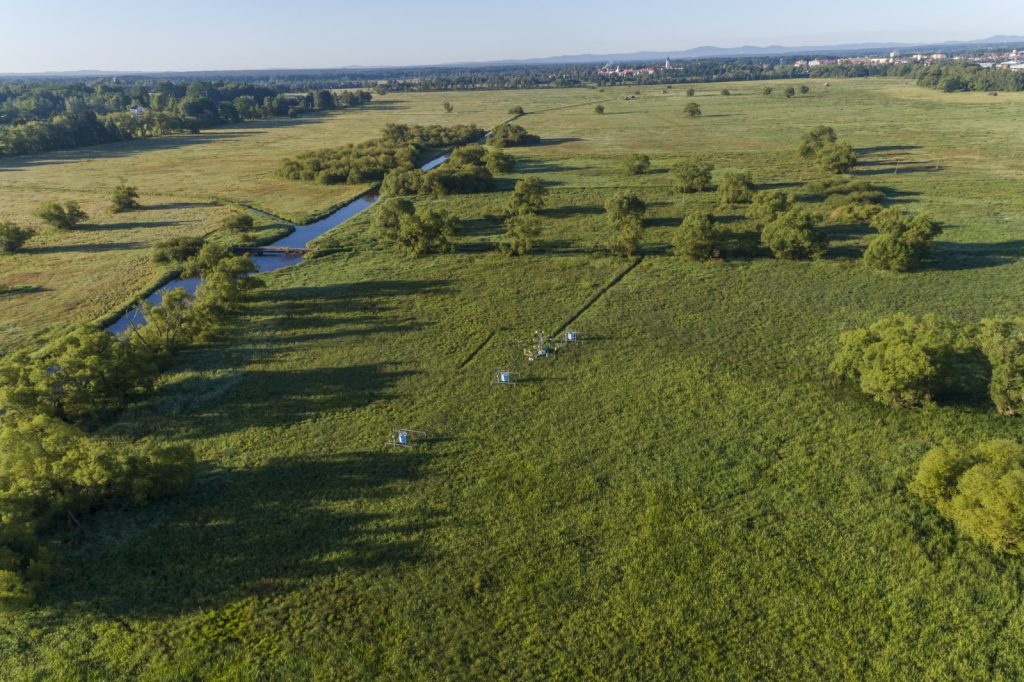
During his visit to the South Bohemian Region (April 4, 2024), the Minister of the Environment, Petr Hladík, ceremoniously opened a new hall with the production of heat pumps in Milevsko, he debated with students at the Fishery Vocational School in Třebon, discussed the placement of photovoltaics on heritage-protected buildings and together with the scientists from CzechGlobe he visited the measurement station, which captures the amount of CO2 in wetlands and evaluates the state of the landscape and soil.
More On April 1, the new project of the European research infrastructure IRISCC (Integrated Research Infrastructure Services for Climate Change risks) focused on the risks caused by climate change was officially launched. The project, which is coordinated by Janne Rinne from the Natural Resources Institute Finland (Luke), integrates 14 research infrastructures and e-infrastructures and brings together 80 partners from all over Europe, including scientists from CzechGlobe and its infrastructure.
More On January 30, 2024, a panel discussion on the EU Missions: rethinking governance and policymaking was held in Brussels. The event was organized by the independent think-tank Friends of Europe in collaboration with the consortium of the Horizon Europe SSH – CENTRE project (Social Sciences and Humanities for Climate, Energy and Transport Research Excellence).
The Missions represent a new concept within the Horizon Europe programme which is supposed to provide tangible solutions to the cross-cutting societal challenges of today with the aim of supporting the transformation of Europe into a greener, healthier, more inclusive and resilient continent by advocating for a significant restructuring of governance and policy-making processes.
Insight into politics is one of the main activities of the SSH-CENTRE project, which brings together 13 partners from across Europe. The project directly engages stakeholders – researchers, policymakers, representatives of businesses, civil society, and citizens – in strengthening social innovations, promoting SSH-STEM collaboration (social sciences and humanities with science, technology, engineering, and mathematics), and in transdisciplinary policy consultancy to accelerate the EU’s transition to carbon neutrality.
The success of the Missions requires a fundamental change in the functioning of governments and institutions and a redefinition of the relationship between businesses and governments. Whether such a change has been observed after three years of the programme was the subject of the panel discussion. Additionally, there was a dialogue on defining key monitoring indicators, increasing synergies with other programmes at EU level, exploring further prospects of the Missions, and directing investments into research and innovation.
The SSH-CENTRE project was represented in the panel discussion by Julia Leventon from CzechGlobe, who, among other things, deals with changes in decision-making and management processes towards sustainability and is also working on creating interdisciplinary and transdisciplinary research to achieve sustainability goals. The other three panelists were representatives from DG Clima, DG Environment and the European Parliament.
The recording of the panel discussion can be viewed here.
More 
Just released the new issue of the CzechGlobe Newsletter
More