Provider: Ministerstvo školství mládeže a tělovýchovy
Recipient: Ústav výzkumu globální změny AV ČR, v. v. i.
Keywords: Marginalised mountain areas, Environmentally Sensitive Area Index, Landscape ecological stabiity, Cataloque of restoration measures
Annotation of project:
The main activities of the project will be the
modification of the prepared methodology for the
assessment of the Environmentally Sensitive Area Index
(ESAI), formation of a set of indicators of environmental
parameters of ecological stability and preparation of a list of
adaptation measures that improve the conditions for
maintaining or supporting the sustainable use of natural
resources. A practical outcome of the project will be the c
reation of an interactive specialized map for user-friendly
application by stakeholders.
Click for the search
Number of projects found: 285
Greenhouse gas flux dynamics in forest ecosystems and the effects of drought episodes, elevated atmospheric CO2 concentration, and nitrogen deposition
Provider: Ministerstvo školství mládeže a tělovýchovy
Recipient: Ústav výzkumu globální změny AV ČR, v. v. i.
Keywords: Methane, CH4, nitrous oxide, N2O, carbon dioxide, CO2, greenhouse gas fluxes, physiology of forest trees, forest ecosystem, nitrogen deposition, drought, elevated CO2 concentration, climate change, multifactorial manipulation experiments
Annotation of project:
We aim i)to reveal emission potentials of CH4 and N2O for various European tree species of temperate zone, ii) to study the effect of environmental parameters (e.g., reduced water availability, elevated CO2 concentration and N deposition) and their interactions on CH4 and N2O fluxes from soils and trees, and iii) to quantify losses of C and N from soils and trees in form of gaseous CH4 and N2O under the effect of N deposition and soil water availability.
Three-dimensional forest ecosystem monitoring and better understanding by terrestrial-based technologies (3DForEcoTech)
Provider: Ministerstvo školství mládeže a tělovýchovy
Coordinating recipient: Ústav výzkumu globální změny AV ČR, v. v. i.
Keywords: Airborne laser scanning; unmanned laser scanning; terrestrial laser scanning; radiative transfer model; DART; 3D tree reconstruction; quantitative structure model; forest characteristics; mechanical stability; above ground biomass; growing stock
Annotation of project:
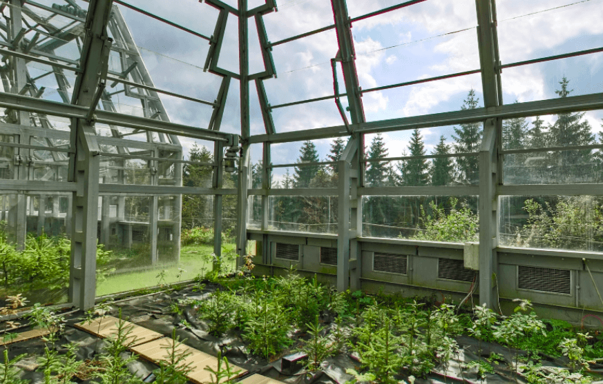
Ecological stability (resistance and resilience) of a forest stand against various disturbances and stress factors is partially dependent on canopy structure, which reflects species and age variability in the canopy. Characteristics such as height, crown shape, and above ground biomass (AGB) can be derived from field measurements. These are often time and manpower consuming and thus clearly time and spatially limited, whereas methods using unmanned and airborne laser scanning (ULS and ALS) allow mapping large areas repeatedly. Though, even those methods rely on field data, which are used for calibration of regression models and for their independent validation. In this project, we therefore introduce an approach replacing field data by virtual 3D forest stands. Terrestrial laser scanning data will be used to construct realistic 3D tree representations of common species (spruce, pine, beech, oak). From these virtual forest stands with a large structural variability will be compiled, on which laser scanning data will be simulated by RTM. The simulated data will be used to derive a reliable individual tree detection algorithm from ULS, to improve an ABA method for forest characteristics retrieval from ALS, and to introduce advanced methods to assess tree/stand mechanical stability. Activities of the project are closely related to already running COST action 3DForEcoTech (CA20118), which aims to support research of forest ecology by using modern and constantly developing 3D laser scanning methods and bring them closer to forestry practice.
Coordinating recipient: Ústav výzkumu globální změny AV ČR, v. v. i.
Keywords: Airborne laser scanning; unmanned laser scanning; terrestrial laser scanning; radiative transfer model; DART; 3D tree reconstruction; quantitative structure model; forest characteristics; mechanical stability; above ground biomass; growing stock
Annotation of project:
Ecological stability (resistance and resilience) of a forest stand against various disturbances and stress factors is partially dependent on canopy structure, which reflects species and age variability in the canopy. Characteristics such as height, crown shape, and above ground biomass (AGB) can be derived from field measurements. These are often time and manpower consuming and thus clearly time and spatially limited, whereas methods using unmanned and airborne laser scanning (ULS and ALS) allow mapping large areas repeatedly. Though, even those methods rely on field data, which are used for calibration of regression models and for their independent validation. In this project, we therefore introduce an approach replacing field data by virtual 3D forest stands. Terrestrial laser scanning data will be used to construct realistic 3D tree representations of common species (spruce, pine, beech, oak). From these virtual forest stands with a large structural variability will be compiled, on which laser scanning data will be simulated by RTM. The simulated data will be used to derive a reliable individual tree detection algorithm from ULS, to improve an ABA method for forest characteristics retrieval from ALS, and to introduce advanced methods to assess tree/stand mechanical stability. Activities of the project are closely related to already running COST action 3DForEcoTech (CA20118), which aims to support research of forest ecology by using modern and constantly developing 3D laser scanning methods and bring them closer to forestry practice.
ENVision
Provider: Masarykova univerzita
Recipient: Ústav výzkumu globální změny AV ČR, v. v. i.
Keywords: xxx
Annotation of project:
Remote sensing data – obtained from satellite or airborne imagery – play an essential role in many applications, especially in the timely assessment of the state of a landscape. CESNET organization provides a data warehouse (national point) of Sentinel satellite data for the Czech Republic and a visualization portal providing basic capabilities for their elementary analysis. This project aims to develop a comprehensive data-analytical solution ENVision, which will provide a modularly extensible and scalable platform for advanced analysis of such satellite data. For local refinement of global analyses or locally specific analytical methods, the platform will also provide the possibility to import locally acquired airborne or drone da-ta, which are acquired and managed by, among others, the Institute of Global Change Re-search Institute of the Czech Academy of Sciences (CzechGlobe). In addition to integrating previously developed prototypes of analytical methods that process and analyze remote sens-ing data, the project will also test the potential of machine learning and artificial intelligence techniques to refine these previously used analytical methods for assessing the state of forest ecosystems based on satellite data.
AdAgriF - Advanced methods of greenhouse gases emission reduction and sequestration in agriculture and forest landscape for climate change mitigation
Provider: Ministerstvo školství mládeže a tělovýchovy
Coordinating recipient: Ústav výzkumu globální změny AV ČR, v. v. i.
Another participant in the project: Mikrobiologický ústav AV ČR, v. v. i.
Another participant in the project: Česká zemědělská univerzita v Praze
Keywords: Sustainable agriculture, sustainable forestry, carbon farming, regenerative farming, agrosystems, climate change impacts, climate change adaptation, climate change mitigation, greenhouse gases, CO2, CH4, N2O, crops, forests, soil, stable carbon, plant root exudates, flexible agronomy and forestry management practices, remote sensing, land surface modelling, inverse modelling, crop growth models, agrosystem and forestry systems models, flexible management in agronomy and forestry, ecosystem, landscape, region, sustainability, environmental risks, holistic approach, socioeconomic scenarios, participation, leverage points, science-policy-practice interface, ESFRI research infrastructures, training, capacity building
Annotation of project:
International AdAgriF scientific team aims to turn agriculture and forestry into long-term sinks and stocks of carbon and prevent avoidable emissions of CO2, N2O, and CH4. This will be achieved by greatly modernized infrastructure and three transdisciplinary research WPs spanning from molecules to landscape and society. The research will be imbedded in extensive network of excellent collaborating institutes fostering the growth of all participating scientists and reducing the research risk.
Towards a network for automated real-time monitoring of Quercus robur L. vitality in the Danube region (NetFor)
Provider: Ministerstvo školství mládeže a tělovýchovy
Recipient: Ústav výzkumu globální změny AV ČR, v. v. i.
Keywords: Riparian forests, dendrochronology, automatic dendrometers, tree water deficit, climate change, drought
Annotation of project:
1. Evaluate tree growth responses in pedunculate oak forests in the Danube region to environmental conditions, including extreme events. 2. Implement a multidisciplinary approach by combining different types of data (long-term interannual tree ring width and high-resolution intra-annual dendrometer data). 3. Develop a predictive monitoring system to track the vitality of these forests in near real-time. 4. Foster a collaborative, learning-through-research environment among a diverse team of researchers.
Geomorphological interpretation of photogrammetry and laser scanning data in the study of torrential watersheds
Provider: Ministerstvo školství mládeže a tělovýchovy
Recipient: Ústav výzkumu globální změny AV ČR, v. v. i.
Keywords: geomorphological analysis, photogrammetry, laser scanning, torrential watershed
Annotation of project:
The main aim of the project is to reveal the spatiotemporal dynamics of torrential/debris flood processes at different landscape conditions in the context of contemporary climate change; and to propose a methodology for evaluation of torrential/debris flood events and determining the type of flows using the innovative technologies (UAS, TLS, and GIS) as an alternative to classic methods of geomorphological research.
4DHYDRO - 4DHYDROLOGY - HYPER RESOLUTION
Provider: European Space Agency
Another participant in the project: Ústav výzkumu globální změny AV ČR, v. v. i.
Keywords: xxx
Annotation of project:
xxx
Another participant in the project: Ústav výzkumu globální změny AV ČR, v. v. i.
Keywords: xxx
Annotation of project:
xxx
Free circulating histone complexes as diagnostic tool for central nervous system (CNS) pediatric cancers
Provider: Ministerstvo zdravotnictví
Coordinating recipient: Fakultní nemocnice u sv. Anny ICRC
Another participant in the project: Ústav výzkumu globální změny AV ČR, v. v. i.
Keywords: cancer, medulloblastoma, histones, high-grade glioma, DIPG, ependymoma, free, circulating, nucloesomes
Annotation of project:
In this proposal, we would like to focus the study on “liquid biopsies” as a novel non/less-invasive tools for cancer diagnosis. We aim at gaining a deep understanding of the variability and combinations of free circulating histones and their complexes, or nucleosomes in various PBTs, and if these can confer detection specificity and prognosis for CNS child patients. Aim 1. Diagnostic and prognostic values of circulating histones in the blood of children affected by medulloblastoma, diffuse intrinsic pontine glioma (DIPG), neuroblastoma and ependymoma. Using ImageStreamX flowmicroscopy system we would like to screen samples of “bio-fluids” samples (blood and cerebrospinal fluid – CSF) of PBT patients for the presence of free circulating histones and their complexes that could have significant diagnostic value, which can be applicable in clinical praxis. Aim 2. Mechanisms of release of histones into the extracellular environment Within this aim we plan to disclose the putative cellular mechanisms, by which histones and their complexes are released from cells into the extracellular environment. Specifically, in vitro cellular systems we will measure the expression levels of chaperone enzymes and we will use siRNA technology to perturb/downregulate the individual chaperones, and accordingly detect whether these approaches would alter the respective secretory profile of extracellular histones.
New methods of evaluating the volume and surface of active and reclaimed landfills
Provider: Technologická agentura ČR
Recipient: Ústav výzkumu globální změny AV ČR, v. v. i.
Keywords: landfill; dump reclamation; waste volume; airborne spectroscopy; remote sensing; UAV; laser scanning; LiDAR;
Annotation of project:
Objectives of the project relate to the use of advanced airborne and UAV remote sensing methods for monitoring of active and closed (reclaimed) landfills. Specifically, objectives are as follows: 1. To develop a procedure for detecting shape and surface changes of an operational landfill using airborne laser scanning data. 2. To develop a procedure for monitoring of closed (reclaimed) landfills and their surroundings using remote sensing data.
virtual infrastructure guide

HRS4R/HR AWARD

News
04/5/
2024
2024
Minister Hladík together with the scientists from CzechGlobe visited wetlands in South Bohemia
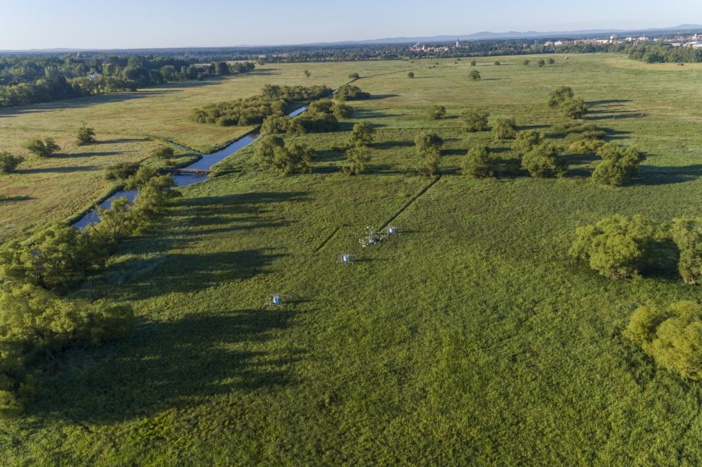
During his visit to the South Bohemian Region (April 4, 2024), the Minister of the Environment, Petr Hladík, ceremoniously opened a new hall with the production of heat pumps in Milevsko, he debated with students at the Fishery Vocational School in Třebon, discussed the placement of photovoltaics on heritage-protected buildings and together with the scientists from CzechGlobe he visited the measurement station, which captures the amount of CO2 in wetlands and evaluates the state of the landscape and soil.
More On April 1, the new project of the European research infrastructure IRISCC (Integrated Research Infrastructure Services for Climate Change risks) focused on the risks caused by climate change was officially launched. The project, which is coordinated by Janne Rinne from the Natural Resources Institute Finland (Luke), integrates 14 research infrastructures and e-infrastructures and brings together 80 partners from all over Europe, including scientists from CzechGlobe and its infrastructure.
More On January 30, 2024, a panel discussion on the EU Missions: rethinking governance and policymaking was held in Brussels. The event was organized by the independent think-tank Friends of Europe in collaboration with the consortium of the Horizon Europe SSH – CENTRE project (Social Sciences and Humanities for Climate, Energy and Transport Research Excellence).
The Missions represent a new concept within the Horizon Europe programme which is supposed to provide tangible solutions to the cross-cutting societal challenges of today with the aim of supporting the transformation of Europe into a greener, healthier, more inclusive and resilient continent by advocating for a significant restructuring of governance and policy-making processes.
Insight into politics is one of the main activities of the SSH-CENTRE project, which brings together 13 partners from across Europe. The project directly engages stakeholders – researchers, policymakers, representatives of businesses, civil society, and citizens – in strengthening social innovations, promoting SSH-STEM collaboration (social sciences and humanities with science, technology, engineering, and mathematics), and in transdisciplinary policy consultancy to accelerate the EU’s transition to carbon neutrality.
The success of the Missions requires a fundamental change in the functioning of governments and institutions and a redefinition of the relationship between businesses and governments. Whether such a change has been observed after three years of the programme was the subject of the panel discussion. Additionally, there was a dialogue on defining key monitoring indicators, increasing synergies with other programmes at EU level, exploring further prospects of the Missions, and directing investments into research and innovation.
The SSH-CENTRE project was represented in the panel discussion by Julia Leventon from CzechGlobe, who, among other things, deals with changes in decision-making and management processes towards sustainability and is also working on creating interdisciplinary and transdisciplinary research to achieve sustainability goals. The other three panelists were representatives from DG Clima, DG Environment and the European Parliament.
The recording of the panel discussion can be viewed here.
More 
Just released the new issue of the CzechGlobe Newsletter
More